Category:Sandrain (Bern)
Jump to navigation
Jump to search
| Object location | | View all coordinates using: OpenStreetMap |
|---|
Deutsch: Sandrain ist ein Quartier, respektive "Statistischer Bezirk", im Stadtteil Mattenhof-Weissenbühl, der auch als Stadtteil III bekannt ist, in der Stadt Bern in der Schweiz. Siehe auch Grenzen Sandrainquartier auf OSM
quarter/"statistical district", in the district Mattenhof-Weissenbühl/quarter III in the city of Bern, Switzerland  | |||||
| Upload media | |||||
| Instance of |
| ||||
|---|---|---|---|---|---|
| Part of | |||||
| Location | Mattenhof-Weissenbühl, Bern, Bern-Mittelland administrative district, Bernese Mittelland administrative region, Bern, Switzerland | ||||
| Area |
| ||||
| Elevation above sea level |
| ||||
 | |||||
Subcategories
This category has the following 18 subcategories, out of 18 total.
Media in category "Sandrain (Bern)"
The following 7 files are in this category, out of 7 total.
-
 Aussicht von der Bundesterrasse (33274500678).jpg 4,032 × 3,024; 5.14 MB
-
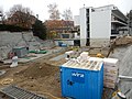 Bern Baugrube Ecke Wabernstrasse Friedheimweg .JPG 4,608 × 3,456; 6.21 MB
-
 Bern Gaswerkareal Sanierung.jpg 4,000 × 3,000; 7.7 MB
-
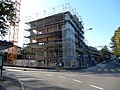 Bern Neubau Ecke Wabernstrasse Friedheimweg.jpg 4,608 × 3,456; 6.27 MB
-
 Bern Sandrain Ballone Staatsarchiv Bern FN Jost G 673.jpg 768 × 509; 64 KB
-
 Hochschule der Künste Bern 018.jpg 1,600 × 1,200; 406 KB
-
 Karte Berner Quartiere Sandrain.png 1,476 × 793; 280 KB
.jpg)


